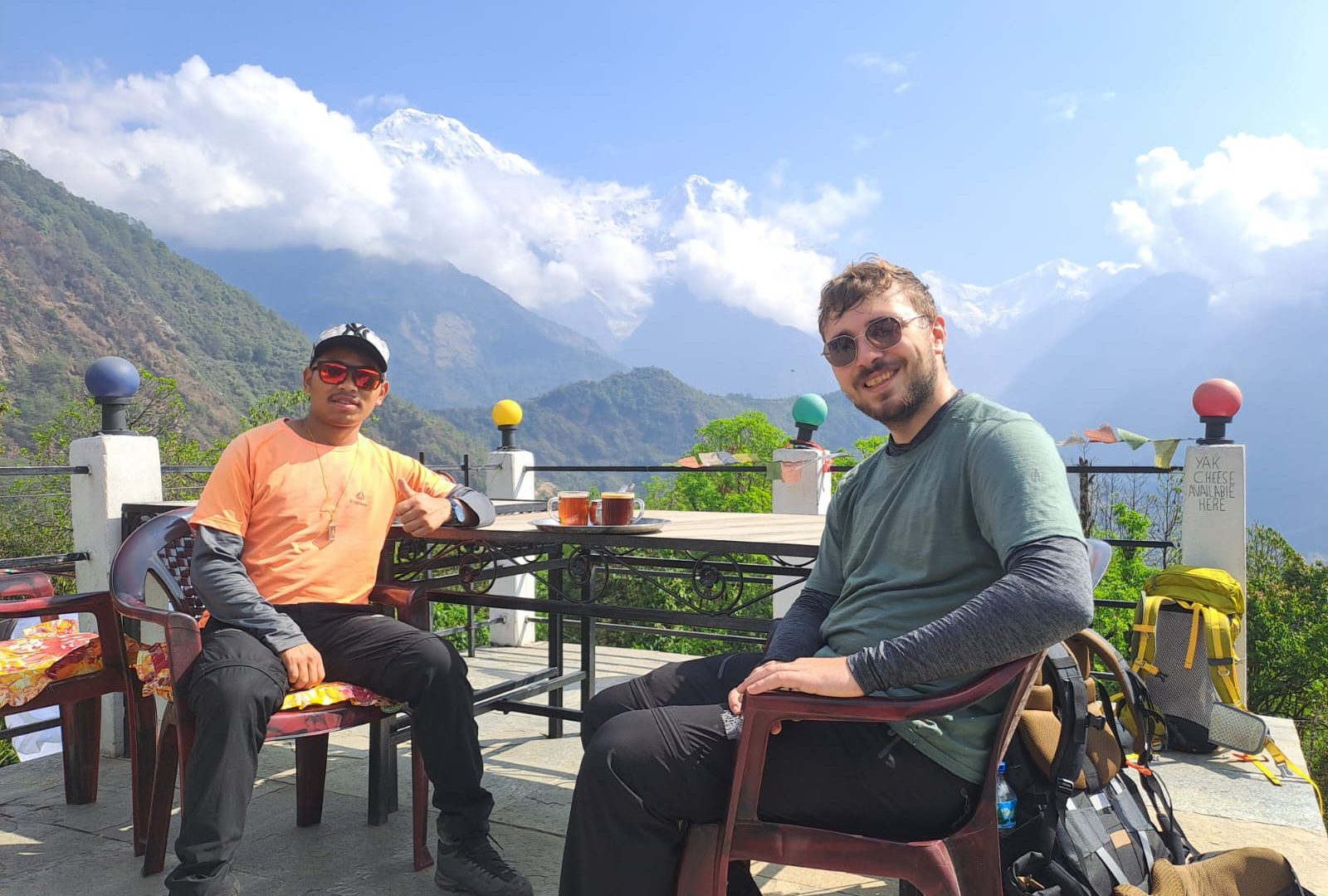
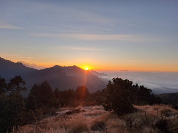
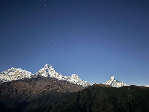
Overview The Ghorepani Poon Hill Trek is Nepal’s most popular short trek with stunning vistas. Also, one of the best introductions to Himalayan trekking anywhere in the world. Located in […]
Duration: 7 Days
Best Time: Spring and Autumn
Trip Grade: moderate
Start from Kathmandu and End to Kathmandu
Min 2 to Max 15 Pax in a group
Meals: Breakfast, Lunch,and Dinner
Accommodation: Tea House
Highlights
Sunrise from Poon Hill (3,210m): a 360° panorama with views of Dhaulagiri I (8,167m), Annapurna I (8,091m), Annapurna South, Nilgiri, Machhapuchhre (Fishtail), Hiunchuli, and the Annapurna Sanctuary peaks
Walk through traditional Gurung and Magar villages like Ghandruk, Ghorepani, Tadapani, Tikhedhunga with distinct stone-and-slate architecture
Rhododendron forests along the Ghorepani–Tadapani ridge: Nepal's national flower, which blooms during March-April, with over 30 species found here.
Natural hot springs at Jhinu Danda, beside the Modi Khola river (easy optional add-on from Ghandruk)
The stone staircase of Ulleri: thousands of hand-laid steps climbing roughly 700m, a well-known test on Day 1 of walking
Village homestays and museums: the Gurung Museum in Ghandruk documents traditional dress, tools, and Gurkha military history
Excellent for photography: misty forest mornings, terraced rice paddies, prayer flags, and mountain views
Overview
The Ghorepani Poon Hill Trek is Nepal’s most popular short trek with stunning vistas. Also, one of the best introductions to Himalayan trekking anywhere in the world. Located in the Annapurna Conservation Area, the route climbs from the subtropical Modi Khola valley through terraced farmland, dense rhododendron and oak forest, and traditional hill villages to the famous sunrise viewpoint of Poon Hill at 3,210m. Over roughly 5 – 7 days of travel, you’ll pass through Gurung and Magar settlements, cross suspension bridges, climb the legendary stone staircase of Ulleri. Likewise wake before dawn for a mind-blowing sunrise with 360-degree view of the Annapurna and Dhaulagiri ranges.
Unlike Annapurna Base Camp or the Annapurna Circuit, this trek stays below 3,300m and doesn’t require any technical skill, specialist gear, or prior trekking experience. That makes it a genuinely good fit for families with children, first-time trekkers, older travelers, or anyone short on time who still wants a mountain experience. It combines everything; teahouse lodges, home-cooked dal bhat, village life, and a proper Himalayan sunrise.
Best Season
Season
Months
Conditions
Autumn (Best)
Late September – November
Post-monsoon clear skies, stable weather, excellent mountain visibility, warm days and cool nights. The most popular trekking season.
Spring (Best)
March – May
Rhododendron and magnolia blooms, mild daytime temperatures, generally good visibility. Afternoon haze may appear by late April.
Winter
December – February
Cold temperatures, especially around Ghorepani and Poon Hill (drops to around 0°C). Occasional light snow above 2,500m. Clear skies and quieter trails.
Monsoon
June – August
Frequent rain, slippery stone steps, leeches in lower forest sections, and limited mountain views. Generally avoided, though landscapes become lush and green when skies clear.
Altitude Profile
Location
Altitude
Notes
Kathmandu
1,400 m
Starting point
Pokhara
820 m
Gateway city to the Annapurna region
Birethanti
1,025 m
Trailhead and permit checkpoint
Tikhedhunga
1,540 m
Lunch stop, base of the Ulleri staircase
Ulleri
1,960 m
Overnight stop, top of the stone staircase
Ghorepani
2,860 m
Overnight stop, base for Poon Hill
Poon Hill (Viewpoint)
3,210 m
Highest point of the trek
Deurali
2,940 m
Ridge crossing en route to Tadapani
Tadapani
2,630 m
Overnight stop
Ghandruk
1,940 m
Overnight stop, largest Gurung village on the route
Nayapul
1,070 m
End of trekking, road access
Maximum altitude you will reach is 3,210m which comfortably below the range where altitude sickness becomes a serious risk. But, after 3000m symptoms can be seen and altitude is a concern so we shouldn’t completely neglate it. The trek still involves daily ascent and descent (some days gain or lose 800m+), so a basic level of fitness and a steady pace matter more than altitude itself.
Symptoms of Altitude Sickness
The common symptoms of altitude sickness include:
Headache (the most common symptom)
Nausea or vomiting
Loss of appetite
Dizziness or lightheadedness
Fatigue or unusual tiredness
Difficulty sleeping
Shortness of breath with exertion
Some of the preventive measures that you can follow are as follows:
Ascend slowly whenever possible, especially above 2,500 m (8,200 ft).
If traveling to very high altitudes, spend a night or two at an intermediate elevation first.
Stay well hydrated, but avoid alcohol before and during ascent.
Get adequate rest and eat regular, carbohydrate-rich meals.
Food & Accommodation
Accommodation is usually in Teahouses (family-run lodges) in the entire route, closely enough that you’re never more than a few hours from the next one. Rooms are typically twin-share with two single beds, a shared squat or Western-style toilet down the hall, and thin walls. You can just expect basic but clean conditions rather than luxury at this places. In Ghorepani and Ghandruk, some lodges offer rooms with attached bathrooms and hot showers (gas or solar, usually charged separately, NPR 200 – 500). Blankets are provided everywhere, but nights above 2,500m get cold, so a sleeping bag (or at least a liner) is worth carrying, especially in winter. Rooms are simply furnished, don’t expect heating beyond a shared dining-room stove in the evening. Here you eat the meal and where you can socialize with other trekkers.
Food in every teahouse runs on a broadly similar menu. Dal bhat (steamed rice, lentil soup, vegetable curry, and pickle) with free refills till you are full is the the most reliable, filling choice at altitude. Beyond that noodles, soups, fried rice, momos (dumplings), potato dishes, porridge, pancakes, and simplified Western options like pizza and spaghetti are also available. Menus get shorter and prices rise the higher you climb. This is because everything is carried up by porters or mules. Breakfast is typically eaten before departure; lunch is taken en route at a teahouse; dinner and overnight are at the same lodge.
Boiled water, hot lemon, ginger tea, and garlic soup (locally believed to help with acclimatization) are available everywhere. Bottled water is sold too, but its use is discouraged due to the plastic waste it generates on the trail. Several villages now have safe refill stations where you can refill water and add purification tablets for extra safety. Coffee, hot chocolate and other bevrages are also available. Alcoholic beverages are pricier and best avoided at altitude.
Most teahouses offer Wi-Fi (Everest Link/NTC card, or a small per-hour fee) and phone/battery charging (often chargeable, NPR 100–300). But the signal and speed both get patchier as higher we go and to more remote the village.
Culture
The trail runs through the heartland of the Gurung and Magar peoples, two of Nepal’s indigenous hill communities, both historically well known for their contribution to the British and Indian Gurkha regiments. A history you’ll see referenced in village museums and old photographs displayed in lodges. Architecture along the route is distinctive: stone-walled houses with slate or thatched roofs, tightly clustered around narrow lanes, quite different from the brick-and-tin construction of the lowlands. Ghandruk, the largest village on the route, has preserved much of this traditional layout and is home to a small Gurung Museum covering local dress, farming tools, weaponry, and Gurkha history.
Religiously the region blends Hinduism, Tibetan Buddhism, and older animist practices — you’ll pass prayer flags, mani (stone) walls, chortens, and small monasteries, particularly in the higher villages closer to Ghorepani. Local custom is to pass mani walls and chortens with them on your left. Hospitality is a genuinely strong local value — offering tea to guests, warm greetings (“Namaste”), and pride in showing off the village are all common. As courtesies: ask before photographing people directly, dress modestly (covering shoulders and knees) when passing through villages and near religious sites, and remove shoes before entering someone’s home if invited in.
Permits Required
Two permits are mandatory for this route, checked at Birethanti and again at intervals along the trail. When you book with us, all the permits are handled by our team before the departure.
Permit
Foreign nationals
SAARC nationals
ACAP (Annapurna Conservation Area Permit)
NPR 3,000 (USD 25–30)
NPR 1,000
TIMS Card (Trekkers’ Information Management System)
NPR 2,000 (USD 15–20) solo/Green
NPR 1,000
Total permit costs roughly around USD 45-50 per person. It can be obtained in Kathmandu or Pokhara at the Nepal Tourism Board office before heading to the trail. Issuance at the Birethanti checkpoint is possible but not recommended (slower, and sometimes costs more). Bring your passport and 2 passport-sized photos; permits are checked at every checkpoint along the trail, so keep them accessible.
Both permits are single-entry, non-refundable, and non-transferable, and their validity is tied to what you state on the application, so fill in dates and route carefully. ACAP revenue funds trail maintenance, conservation, and community projects across the wider Annapurna Conservation Area; TIMS exists primarily for trekker safety and search-and-rescue tracking.
(Permit rules, prices, and solo-trekking regulations have shifted more than once in recent years, reconfirm current requirements with our agency or the Nepal Tourism Board close to your departure date.)
Guide and Porter
Legally, you don’t need a guide or porter for this particular route. Nepal’s stance on solo trekking in the Annapurna region has flip-flopped a bit over the years, so double-check the rules before you go. That said, most people doing this for the first time bring one or both along anyway, and honestly, it’s easy to see why.
A guide does more than just point you in the right direction. They’ll handle the permit checks at each stop, get your room booked ahead of time in places like Ghorepani where things fill up fast, and share bits of local history and culture as you walk. If something goes wrong health-wise, they’re usually your first line of help too.
Then there’s the porter, who’ll take your main bag off your hands (usually 10-15 kg, sometimes split between two hikers) so you’re just carrying a light daypack. You’ll really appreciate this on the Ulleri staircase, which is no joke. n that works well on a route like this since it’s short and easy to follow.
As for cost, figure around $25-35 a day for a guide, $15-20 for a porter, or $20-25 if you go with a porter-guide. That usually covers their food and lodging too, and it’s customary to tip at the end somewhere around 10-15% of your total trip cost, split among the crew.
Itinerary
If you want tailor-made trip or want to personalize this itinerary, just feel free to contact us. We are always there to help you to make your holiday plan. Contact us
Day 01
Arrival in Kathmandu (TIA)
Altitude1350 m
AccommodationHotel
MealsBreakfast
Land at Tribhuvan International Airport, where you'll be met and transferred to your hotel by our company’s representatives. Rest of the day free, or use it for a walk around Thamel. Trip briefing, permit paperwork, and an equipment check will be held in the evening. Overnight in Kathmandu.
Day 02
Drive/fly Kathmandu to Pokhara
Altitude822 m
AccommodationHotel
MealsBreakfast, Lunch,and Dinner
Roughly it takes 6-7 hours by tourist bus or private vehicle along the Prithvi Highway, with scenic vistas, also mountain views (a 25-minute flight is a common alternative if time is tight).
Afternoon, you are free by Phewa Lake. A good time to roam around,explore the city and to double-check permits, rent or buy any last-minute gear. Overnight in Pokhara.
Day 03
Drive Pokhara to Birethanti, trek to Ulleri
AccommodationTea house
MealsBreakfast, Lunch,and Dinner
A drive about 1.5-2 hours by road to Nayapul, then to the permit checkpoint you reach to Birethanti (1,025m), where the trek begins. The trail follows the Modi Khola river through Sudame and Tikhedhunga (lunch stop), then climbs the well-known stone staircase roughly 3,000 steps gaining about 700m into Ulleri (1,960m) (around 5–6 hours of walking). This is generally regarded as the toughest single climb of the trek. Overnight in Ulleri.
Day 04
Trek Ulleri to Ghorepani
AccommodationTea House
MealsBreakfast, Lunch,and Dinner
A steadier, still-uphill day through progressively cooler forest of oak and rhododendron via Banthanti and Nangethanti to Ghorepani (2,860m) (around 5-6 hours). Clear days bring the first real mountain views on arrival, with Annapurna South and Dhaulagiri visible from the village itself. Overnight in Ghorepani.
Day 05
Poon Hill sunrise, trek to Tadapani
AccommodationTea House
MealsBreakfast, Lunch,and Dinner
A pre-dawn start (around 4:30-5am) for the roughly 45-minute climb up to Poon Hill (3,210m). You reach to the top for sunrise over the Annapurna and Dhaulagiri ranges, the most anticipated moment of the trek. Return to Ghorepani for breakfast, then continue via Deurali (2,940m) through dense rhododendron forest, descending to Tadapani (2,630m) (around 5-6 hours in total for the day, including the sunrise accent). Overnight in Tadapani.
Day 06
Trek Tadapani to Ghandruk
AccommodationTea House
MealsBreakfast, Lunch,and Dinner
A mostly downhill day through forest, with strong views of Annapurna South and Machhapuchhre for much of the descent, into Ghandruk (1,940m) (around 4-5 hours) the largest and most traditional Gurung village on the route. Afternoon free to explore the village, visit the Gurung Museum, and see terraced fields against the mountain backdrop. Overnight in Ghandruk.
Day 07
Trek Ghandruk to Nayapul, drive to Pokhara
Altitude822 m
AccommodationHotel
MealsBreakfast
Descend via Kimche and Syauli Bazaar back to the road at Nayapul (around 4 -5 hours), then drive back to Pokhara (around 1.5-2 hours). Evening free by the lake to celebrate finishing the trek. Overnight in Pokhara.
(Optional extensions: route Day 6/7 via Jhinu Danda for a hot-springs soak beside the Modi Khola; or add a further Kathmandu day at the end for sightseeing/shopping before departure.)
Inclusions
What's included
Airport pick-up and drop-off by private vehicle.
Kathmandu – Pokhara – Kathmandu transportation by tourist bus (both ways).
Private transportation between Pokhara and Nayapul (or the trek starting/ending point) (both ways).
Two nights' hotel accommodation in Kathmandu with breakfast.
Two nights' hotel accommodation in Pokhara with breakfast.
Twin-sharing teahouse/lodge accommodation during the trek.
Three meals a day (Breakfast, Lunch, and Dinner) during the trek.
Guide and porter salaries, meals, accommodation, transportation, equipment, and insurance.
Annapurna Conservation Area Permit (ACAP).
TIMS (Trekkers' Information Management System) Card (if applicable).
Comprehensive first aid kit carried by the guide.
All applicable government taxes and service charges.
Himalayan Guide Treks
What's not included
International airfare
Nepal entry visa fee
Travel and medical insurance (including emergency helicopter evacuation)
Personal trekking equipment and clothing
Hot showers, Wi-Fi, battery charging, laundry, and telephone calls
Bottled water, soft drinks, alcoholic beverages, and extra snacks
Personal expenses and shopping
Tips for guides, porters, and drivers
Frequently Asked Questions
How difficult is the Ghorepani Poon Hill Trek?
It's rated easy to moderate in level of difficulty. No technical climbing or scrambling, but several long, steep sections (especially the Ulleri staircase). A basic level of fitness makes it far more enjoyable. Daily walking is typically 5 - 6 hours.
Do I need previous trekking experience?
No. It's widely recommended as a first trek in Nepal. Suitable for childrens, teenagers, older trekkers, and reasonably fit beginners, as long as you're comfortable walking several hours a day on uneven ground.
Do I need a guide or porter?
Not strictly required by law for this route, though rules on solo trekking have shifted in recent years, check current requirements before you go. Many trekkers hire a guide and/or porter regardless, for local knowledge, easier permit logistics, and to support the local economy; a porter typically carries 10-15kg between two trekkers.
What should I pack?
Layered clothing (t-shirts to a warm fleece/down jacket), a waterproof shell, sturdy broken-in trekking boots, trekking poles, a warm hat and gloves (especially outside summer), a headlamp for the pre-dawn Poon Hill climb, sunglasses, sunscreen, a basic first-aid kit, and a reasonably warm sleeping bag or liner if trekking outside peak season.
Is there ATM or money access on the trail?
No reliable ATMs are found beyond Pokhara. Carry enough Nepali rupees in for the entire trek, as card payments aren't accepted at teahouses.
Can I charge electronics and get Wi-Fi along the way?
Yes, in almost every teahouse, usually for a small fee, though speed and signal thin out the higher and more remote you get.
Is the trek suitable for children?
Yes, it's one of the more child-friendly treks in Nepal given the moderate daily distances and lower altitude, though pacing should be adjusted and a guide is recommended for families.
What's the best time to avoid crowds?
Winter (December-February) offers the clearest skies with far fewer trekkers. But you have to be well prepared about the cold.
Can this trek be combined with others?
Yes, it's commonly extended toward Annapurna Base Camp, combined with a Jhinu Danda hot-springs, or paired with a short Pokhara/Kathmandu sightseeing itinerary before or after.
Do I need travel insurance?
Yes, it's required for the trek. Make sure to look for a policy that covers trekking up to at least 3,500-4,000m and includes emergency evacuation for your safety.