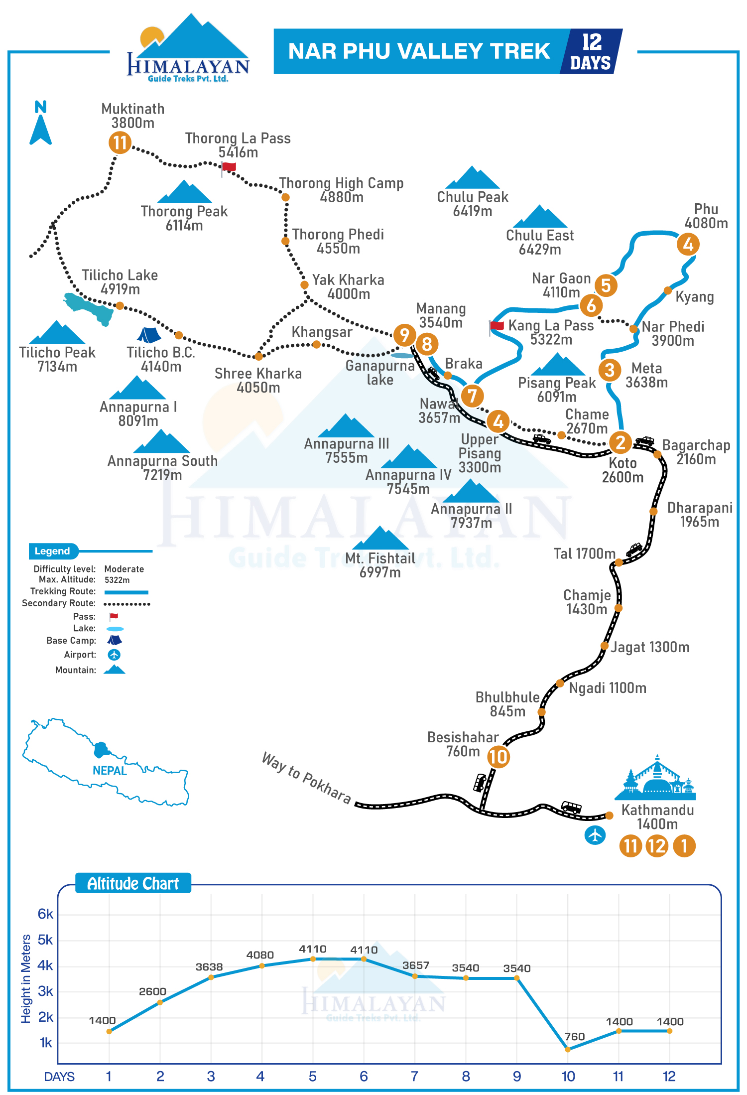
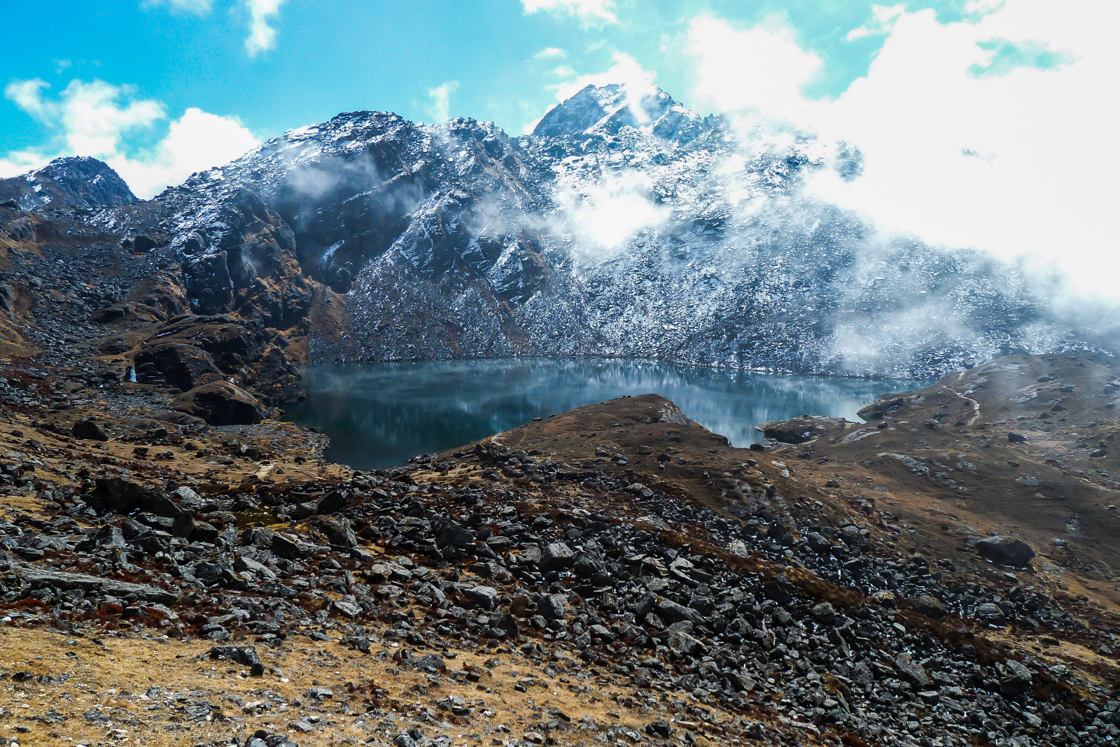
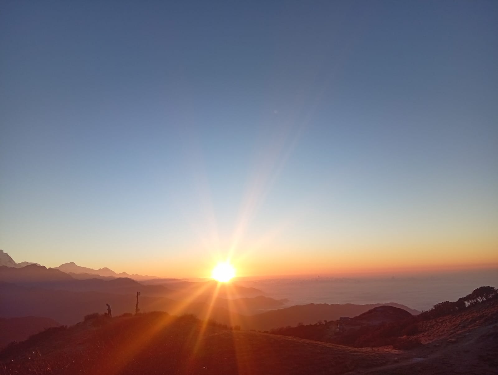
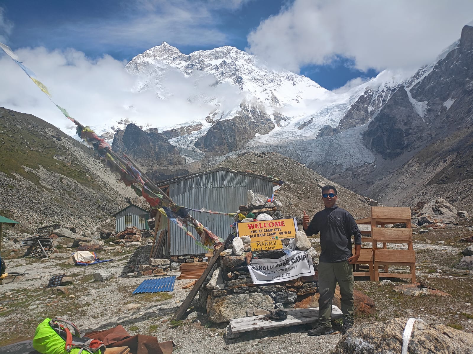
The valley of Nar Phu is often known as a “Hidden Tibetan World in the Annapurna Shadows.”
If you have no idea about this trip or have never heard of it before, it’s ok, cause unlike the all time classic Annapurna circuit trek, Nar Phu Trek isn’t that famous among mainstream trekkers and explorers.
Because just like I said before, it’s like a hidden world, a corner of the Manang district.
Manang is that district alongside Mustang which is known as “District beyond the Mountains”, referring to their status as a rainshadow area, and the very word of this trek comes from the name of the villages “Nar” and “Phu,” two remote Tibetan-style villages with stone houses, ancient Gompas, yak herders, and lifestyle that’s barely touched by modern times.
Sounds like something outta time, doesn’t it?
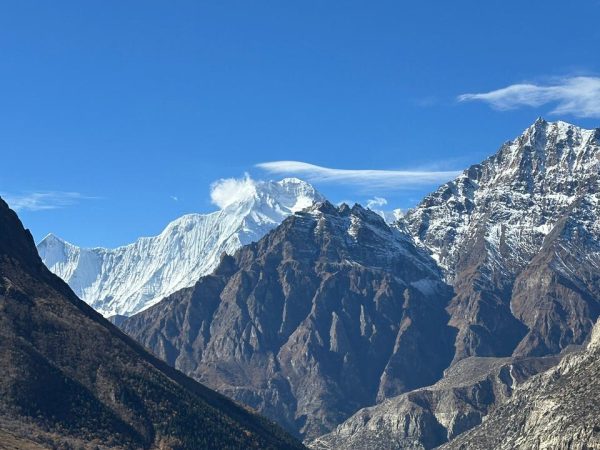
If we talk about the trail, then it’s a dramatic one. It goes through the gorges, pine forests, and high-desert plateaus that are barren and crosses that are very challenging, like the Kang La Pass (5,320m), from where you can get epic views of the peaks Annapurna, Lamjung, Manaslu, and more.
It’s usually around 9-15 days, but it still feels exclusive and profound: Fewer than a hundred trekkers a year. No crowds, mandatory guide, special permits, that’s all.
And you get access to a raw Himalayan wilderness, authentic Tibetan-influenced cultures, and that quiet introspection that comes from walking through a place only a few people reach.
It is perfect if you are craving grounded immersion. And fewer high sky trails. More step-by-step connection to the ancient rhythms, vast silence, and soil.
Weather and season
Now let’s talk about what time of year is good for you to travel. Because if you live on the other side of the earth and plan to get here, the weather and season might not be what you expected when you get here, which is why it’s important to stay updated.
Nar Phu sits in a high, rain-shadow area north of the Annapurna range, so the weather is generally drier and more stable than many other Nepali treks, but it’s still high altitude Himalayan territory- expect cold nights year-round, variable conditions on the Kang La pass 5,320m, and the need for good layers no matter where you go because it’s straight up 5000 meter up in the air from the sea level I hope you understand how cold that is.
Spring (March-May), Awakening and blooming magic.
Nepal works based on the lunar calendar, and so do its weather and seasons.
The month of March falls around the beginning of the Lunar New Year in Nepal, and so does this season, which is why everything starts to wake up as the year kicks off. The greenery returns, the temperature gets warmer, which is not even that hot during daytime as it gets up to 10 to 22 degrees Celsius in lower areas and cooler at higher altitude as for night, it stays cold. The nights might be good on the lower elevations, but on the higher elevations, it goes down to -5 degrees Celsius or even lower on passes.
As for the skies, they are clear after winter. The trail, they burst with rhododendrons and wildflowers and fresh green in the lower regions.
As for the view, it is excellent for those epic Annapurna and Manaslu views.
If you’re a photography enthusiast, then it’s perfect for you with that sense of renewal. It’s a rewarding time to feel the valley coming alive, with the blooming landscape adding color to the stark high-desert scenery.
Crowds are moderate, less than peak (Autumn), making it feel personal and peaceful.
Autumn, September to November. Crystal clear classic.
Often called the absolute best for the Nar Phu. Stable dry weather with deep blue sky. Minimal hedge and sharp. Postcard Perfect Mountain Panoramas. Daytime temperatures range between 10 and 22 °C. Warm lower down, cool higher, nights drop to -5°Celsius or below, and the trails are in great shape with low precipitation.
Golden light bathes the Peak, and gompas, wildlife is active before winter, and the air feels crisp and invigorating.
It is a peak trekking season across Nepal, so Nar Phu sees a bit more traffic than usual, but still far fewer people than the main Annapurna Circuit, giving that quiet, introspective vibe you love. Views from Kang La Pass are at their sharpest, often leaving trekkers speechless in the best way.
Winter (December to February) – Stark, solitary beauty.
Possible, but challenging. Days can be clear and stunning. Bright blue skies, razor-sharp peaks after fresh snow, but nights and high altitudes get bitterly cold, well below the freezing point. -10 degrees Celsius or lower. And there’s no ice on trails and passes increase the risk of slippery sections or closure ( Kang La, especially).
Precipitation is low. Crowds are minimal, almost private, filling. And the stark white landscapes with frozen rivers and snow-dusted gompas have a raw meditative magic. If you’re prepared for the chill (extra warm gear, a good sleeping bag, and flexibility for delays). It’s for those who don’t mind bundling up and want maximum solitude and that profound silence.
Monson/Summer (June to August) Lush but risky
Nar Phu is a rain shadow zone, so it gets less rain than most of Nepal. The trail stays drier, landscapes turn vibrant green with waterfalls and swollen rivers, but clouds often obscure views. Afternoon showers are common, and there’s still landslide mode. Risk in the lower sections.
Visibility drops, making the high passes and peaks harder to see, and flight road access to the trail can be disrupted. It’s doable for very flexible folks who want lush scenery and fewer people, but for the full panoramic immersion and clear mountain drama, most skip it.
If you’re planning, spring or autumn would give you the clearest, most comfortable shot at that Hidden Valley serenity. Nar Phu has that rain shadow advantage, so even shoulder seasons feel more forgiving than wetter regions.
Preparation handouts:
- Sturdy boots
- warm layers
- Good sleeping bag Medicine
- Basic teahouse (No hot shower often)
Etiquette tips: Ask before taking photos in villages/monasteries; leave no trace.
Reason to do the Nar Phu Valley Trek
This trek feels like stepping into a sacred Tibetan enclave; restricted access keeps it pure, so you witness traditions (Gompas, rituals, daily life) that have stayed unchanged for centuries without the commercialization of the region. As for the isolation, it is one of the very core elements that brings profound quietness and serenity.
The vast landscape, where silence lets your thoughts settle, high passes that taste and reward you, and cultural depth that can stir the inner bliss or reflection we talked about.
It’s not the longest or highest, but it’s rare. Few get to walk these trails, feel the mountain breeze echo off canyon walls, or share tea with locals in Phu village.
If you’re after a spiritual calm and a trek that feels personal and earned, not rushed, this one’s a gem. The challenges make the serenity hit deeper, leaving you with the stories of hidden valleys that make you feel like they are waiting for you. Just for you.
Phu Village: The Fortified Medieval Enclave.
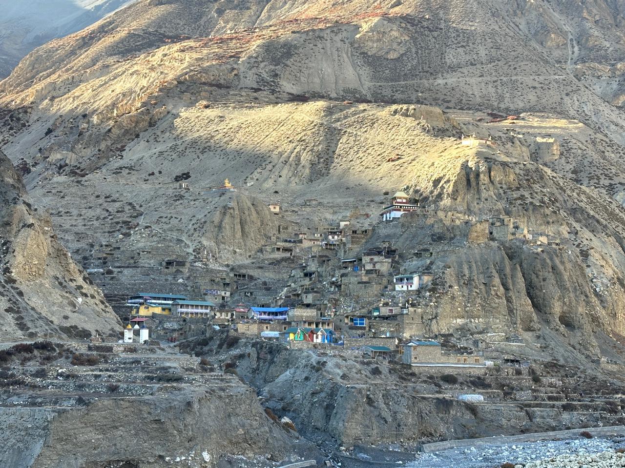
The village of Phu is no less than a time capsule in itself and I’m telling you so because this village right here is a perfect picture of what the Himalayas looked like 4 centuries ago.
Sitting at an altitude of 4,080 meters, it looks less like a modern hamlet and more of a medieval stone fortress that is built directly on the hillside carved out of a Giant rock as if mother nature chiseled it out.
Even when you just look at these structures built, the houses and their architecture are simply mind bending as the flat-roofed, stone houses are stacked on top of each other, overlooking the vast barren canyons.
At first glance, when you look at it, it will feel like a giant staircase. You can find yourself surrounded by people who are part of the local community who still follow the traditional rhythm, the Tibetan culture, the lifestyle of herding yaks and living entirely off the land.
Tashi Lakhang Gompa: The spiritual anchor
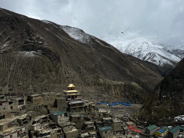
Tashi Lakhang, 700 year old Bud Monastery built by the 10th Karmapa is one of the oldest and still active spiritual sites in the entire region of the Annapurna. Stepping in here means walking into a completely different space.
Right. The very moment you step in, you will start to feel the smell of burning juniper incense, ancient murals, and butter lamps lighting the interior and a very common, peaceful environment that’s very uncommon in today’s world.
It’s not a tourist attraction. It’s a living, a cultural manifestation built for the sustenance of life, something related to consciousness.
It is a living, breathing monastery where silence is only broken by fluttering of thousands of prayer flags by the wind of the valley.
Himlung Himal, Base Camp (4,920m)
The majority of trekkers use Phu as a mandatory acclimatization stop, but the real way to do so is by taking a side trip to the Himlung Base Camp.
At nearly 5000, the terrain is windy, raw and glaciated that puts you face to face with Himlung himal ( 7126m). The trip around takes six to seven hours of navigating loose moraines and wide open glacial valleys. If you are someone who loves solitude and a few people around then this is the best place for you. There are no crowds here, just empty trails, grazing blue sheep and massive towering walls of ice and snow.
Nar Phedi and Nar Village, the land of monasteries
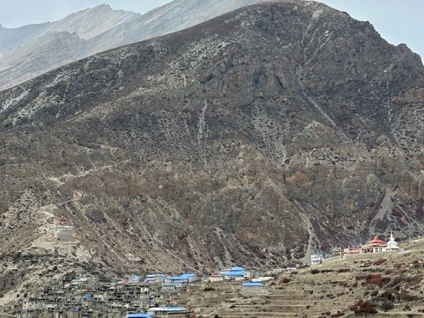
While the village of Phu is more like a rugged fortress, the village of Nar is wider, greener and deeply spiritual point.
Sitting at a topography like a high-altitude bowl structure surrounded by barley fields, it is a home to a high concentration of ancient monasteries.
You will pass Nar Phedi, a secluded monastic institute down in the Valley, where local nuns offer basic beds and authentic hospitality to the few trekkers who pass through, before you reach the main village.
The Kang La Pass (5,320m)
This right here is the ultimate physical hurdle of the entire trek.
The Kang La is the highest altitude point that connects the isolated Nar valley back to the mainstream on the Annapurna Circuit. The climb is brutal and unforgiving and since we’ll be starting our walk pre dawn it’ll also be more of a mental endurance test up the steep frozen scree ladders.
The climb will be a harsh test, but believe me, when you reach the top the reward will be rewarded with a ridiculously beautiful view. The 360 degree panoramic view with the beauty of nature, where the Annapurna massif and the Gangapurna feels close enough to touch.
It’s surreal.
Important notes
Since you are traveling in a Himalayan nation dominated by the majority of the world’s highest peaks, forests, and new Flora, fauna, and cultures, and of elevation up to 5000 meters. So you need to know certain details as an important reminder for your own benefit.
So, now let’s talk about some important notes you need to remember, as given below:
Restricted area
A Special Restricted Area Permit (RAP), along with an Annapurna Conservation Area permit (ACAP), is required. The agency handles, the region limits visitors, for cultural and Environmental Protection.
Altitude and health
Since the trip goes beyond 5,000 meters, the oxygen starts to thin out with an obvious possibility of altitude sickness, which occurs after crossing the 2,500 meters vertically. Most of the people who have not had previous trekking experience in such regions get altitude sickness easily, or are those kinds of people who experience altitude sickness issues first, after crossing the Kang La Pass.
Which is why it is recommended for everyone to acclimatize in Nar Phu villages, in order to avoid it, and also to deal with the situations in the aftermath.
Follow the rules like hydrating well, moving slowly, descending if needed, and please don’t ever push yourself beyond the limit, cause that’s not how it works, it’s not billionaire motivation or Never give up stuff that works in here.
Here, when the mountain gives you a sign to stop, you stop, no questions asked cause your life matters more than motivational stuff.
So whenever you start to feel uneasiness, stop and inform your guide or anyone and someone near you.
The guides are experienced and well-trained personnel, and they’ll help you deal with situations like this.
And most importantly, something that needs to be done beforehand is the insurance for helicopter evacuation to take you to a better medical facility; without it, you’re stranded.
Note: Indulge yourself in short walks, daily morning and evening exercise, proper rest and hydration since it helps the physique to adjust, adapt to the altitude and complete the trip smoothly by reducing the risk related to AMS to the maximum extent.
Best Alternatives to the Nar Phu Valley Trek
- Tsum Valley – A remote Himalayan valley with ancient monasteries, Tibetan culture, and peaceful villages.
- Upper Mustang – Known for its desert-like landscapes, cave monasteries, and the historic walled city of Lo Manthang.
- Manaslu Circuit Trek – Offers spectacular mountain scenery, remote trails, and the challenging Larkya La Pass.
- Kanchenjunga Base Camp Trek – One of Nepal’s most secluded trekking adventures with pristine wilderness and dramatic Himalayan views.
- Rolwaling Valley Trek – A hidden valley trek featuring glaciers, alpine lakes, and authentic Sherpa culture.