Rupina La Pass, Tsum Valley, Ganesh Himal & Manaslu Circuit Trek

Introduction Rupina La Pass, Tsum Valley, Ganesh Himal & Manaslu Circuit Trek: if you crave true, untouched adventure within this specific timeframe, then this is the ultimate backcountry experience. With […]

Duration: 27 Days
Best Time: Spring and Autumn
Trip Grade: moderate_strenuous
Start from Kathmandu and End to Kathmandu
Min 2 to Max 14 Pax in a group
Meals: Breakfast, Lunch,and Dinner
Accommodation: Tea House or Lodge

Highlights

  • Airport transfers - pickup and drop off
  • Meals on full board (Breakfast, lunch and dinner) during trekking period.
  • 2 nights 3 star hotel in Kathmandu
  • An experienced Government-licensed guide.
  • Food, drinks, accommodation, insurance, salary, equipment, transportation, local tax for guides and porters.
  • Public bus from Kathmandu to Barpak.
  • Besisahar to Kathmandu by private car.
  • All transfer to Bus station by private vehicle
  • All necessary permits and special paperwork
  • All government taxes and our service charges.
  • Farewell Dinner before departure.
  • Himalayan Guide Treks T-shirt

Introduction

Rupina La Pass, Tsum Valley, Ganesh Himal & Manaslu Circuit Trek: if you crave true, untouched adventure within this specific timeframe, then this is the ultimate backcountry experience.

With an experience for bravehearts, and the walk route for at least 5 to 7 hours a day, pushing through nature’s most thrilling and rugged wilderness, this journey is unique in how it seamlessly integrates and blends nature’s raw art and craft with profound cultural experiences.

One week, you are navigating the hidden ancient Tibetan Buddhist sanctuaries of the Tsum Valley, and the very next week you are tackling the high-altitude challenges of the Rupina La Pass.

Surrounded by towering peaks of the Manaslu and Ganesh Himal ranges for the majority of the time on the trail, this adventurous trip provides a masterclass in alpine cultural and biological diversity and isolation of alpine villages along with dramatic icy and glacial landscapes, for any adventure lovers who want to escape the hustle and bustle of regular life and want to experience the authenticity of Himalayan life, this trek is a pinnacle.

Highlights of the Rupina La Pass

Gorkha: The starting point

Now, for those who are unfamiliar with the history of Nepal, they might feel like what’s so special about the starting point is that it’s a highlight in itself

.But the district of Gorkha isn’t just a topographical highlight; rather, when we are here, it’s the very core of the foundation of modern Nepal where we’ll be standing, as the very conquest of modern Nepal started, which is now known to the world.

The major highlight here we will be witnessing is the palace of the “Founder of modern Nepal”. The “Shree Panch Badamaharaj Dhiraj” Prithivi Narayan Shah, which is located on top of a hill standing on the edge, which also houses the sacred cave of the Lord Gorakhnath.


The Cultural transition.

Another highlight within the Gorkha district is the cultural amalgamation of different ethnic groups. You’ll find a diverse fusion of language and architecture as you transition from lower to higher elevation, and you’ll get to witness the diverse ethnic tapestry, from Hindu heritage in the lower elevations to the beautiful and culturally vibrant Gurung village of Barpak and Laprak before stepping into the Tibetan Buddhist culture of the Tsum Valley.

Visuals of Manaslu and other peaks

Let me make you something clear: when you think about trading in high-altitude elevations and places like Nepal. Which is mainly covered by the. Some of the highest peaks of the world and its panorama. Anywhere or everywhere you go in the high elevations, you will get to witness the visuals of peaks.

The same is during this trip; you will get to witness the ranges and some of the highest peaks of the world like Mount Manaslu, the Bouddha Himalayan range, and the Himalchuli massif, the Shringi Himal and Ganesh Himal.

Wilderness trekking experience.

As for the experience, unlike any other routes where tea houses are there to serve you and facilitate you, keep you warm. This route will have none of it.

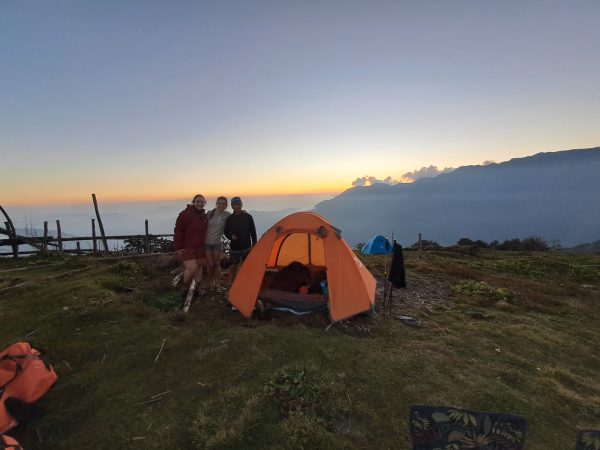
You’ll be camping, cooking for yourself. Staying in a tent or camping services that you carry with yourself along with your Crew members. This right here, this will be the truly wilderness experience, being the part of your trek, which is why this experience feels completely different from the other regular trekking areas.

Chaotic glacial moraine

Now let’s talk about something chilling cold and chilling, alright?
See, we will be travelling and walking several ups and downs, navigating glacial Moraines and icy surfaces, and we’ll be working on thin icy sheets full of risk, thrills, adventure and adrenaline.

Oftentimes, when your steps push into the surface underneath you, you can hear the crisp crackling of the icy sheets. The walk on the glacial moraine will be breathtaking, literally, and very chaotic.
The best thing you need to do what you can do is walk steadily, maintain a good pace and stay calm.

Panoramic Twin Valley

Let’s talk about the panoramic Twin Valley.
But before that, let’s know why it is called the “Twin Valley”.
The nickname Twin Valley is given to it as you are standing at the crest of the Rupina La Pass (4,720 m) and balancing on a geographical knife-edge, with two entirely different worlds and river systems.

While you look back, you will get to see the lush, terraced and Gurung-dominant Valleys that are carved by the Daraudi River, and while you look forward, it reveals the stark, rugged granite beauty of the Budhi-Gandaki River that leads into the high alpine Tibetan Buddhist wilderness.

And once you step over this threshold, the twin nature of the trek truly comes to life. You will be transitioning instantly from a wild, self-sufficient camping expedition into a deeply spiritual and culturally rich Tsum Valley. The visual will be a staggeringly contrasting one.

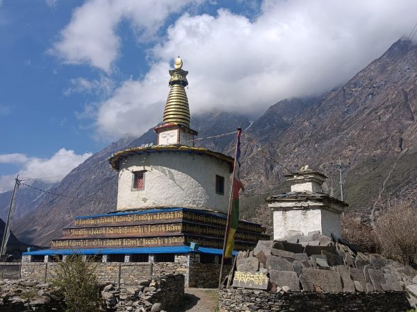
Like one moment you are navigating raw glacial moraines, and next you are walking past ancient mani walls and chortens framed by towering peaks of Manaslu and Ganesh Himal.

Best time to do Rupina La pass with Tsum Valley Manaslu circuit trek


Autumn (October to November)

It is the best time of the year, as the skies are clear and the weather is stable, and the safest conditions for crossing the Rupina La Pass.

Also, the whole nation goes through a clearing session, making the weather and trail crisp, clear, dry, and safe, which is why it is also favoured by the majority of tourists and considered the peak season even if the surroundings aren’t green and filled with blossoms.

Spring (March-May):

Spring is the season when nature wakes up. Lower trails of the Manaslu Circuit come alive as the hillsides burst into the vibrant blanket of blooming red, pink and white wild Rhododendrons.

This season offers comfortably warm daytime hiking temperatures and spectacular, crisp views of the snow-capped peaks against a brilliant blue sky.

There’s something to keep in mind is the fact that During the early springs While you navigate through the trails, there are still the leftover snows and the Heavy snow packs at the high elevations from the winter which gives trekkers a caution to undertake regarding the fact that they should be prepared for the temporary block or Complicated Phases during the crossing of the Larkya La pass As it sometimes makes the pass Impassable.

Required paperwork and permits

Now let’s talk about the official papers that are required to do this trek.
Since the trip combines with highly restricted and sensitive border regions, you will need this specific, detailed paperwork as mentioned below.


Manaslu Restricted Area permit (RAP)

This right here is your primary permit, which is required to trek the trail between the villages of Jagat and Dharapani.
Because it is a border-adjacent zone, pricing fluctuates based on the trekking season and is counted strictly by the number of days you spend inside the restricted area.

As for the pricing of the permits, it varies based on seasons:

Autumn, Peak season (September to November): $100 USD per person for the first seven days.
$15 USD per person for every additional day after the first week.

Winter, spring & summer (December to August): $75 USD per person for the first 7 days.
$10 USD per person for every additional day after the first week.

Tsum Valley Restricted Area Permit (RAP)

If you decide to take a detour to explore the ancient, hidden Tsum Valley before continuing on the main Manaslu Circuit, you must purchase this separate Restricted Area permit. Like the Manaslu RAP, it is season-dependent.

Autumn peak season, September to November: $40 USD per person for the first 7 days.
$7 USD per person for every additional day.

Off-peak season (December to August): $30 USD per person for the first 7 days.
$7 USD per person for every additional day.


Manaslu Conservation Area Project Permit (MCAP)

This permit funds local environmental protection, community development, and trail maintenance from the start of your trek through the high Pass. The prices are fixed year-round and don’t change based on how many days you stay.

  • Foreign Nationals 3000 NPR (approx. $23 to $25 USD)
  • SAARC Nationals: 1000 NPR (approx. $8 USD)


Annapurna Conservation Area Project (ACAP)

Even though this is the Manaslu trek, your descent after crossing the Larkya La Pass takes you into the Annapurna region (Bhimtang down to Dharapani/Besisahar).
Because you exit through this zone, the government requires an ACAP permit. It is also a flat rate and valid for single entry.

Foreign Nationals: 3000 NPR (approx. $23 to $25 USD)
SAARC Nationals: 1000 NPR (approx. $8 USD).

A summarised checklist for the standard circuit (peak season)

If you are doing a standard Manaslu trek (without Tsum Valley) in October, you will typically spend about 10 days inside the restricted zone. Your total permit cost will be calculated like this:

  • Manaslu RAP (7 days+ 3 Extra days: $100+ $45 = $145 USD.
  • MCAP: Approx 23 USD/ 3000 NPR.
  • ACAP: Approx 23 USD/ 3000 NPR.
  • Local municipality fee: approx $8 USD (1000 NPR)
  • Total estimate: ~$199 USD per person.

Packing list and gear guide.

Let’s breakdown about thespecialised gears and the essentials, or whatever accessories you might need during the trip.

  • Footwear: Broken-in trekking boots, camping shoes and high-quality woollen socks.
  • Clothing layers: Moisture-wicking base layers, an insulating fleece, down jacket and a waterproof windproof shell (Vital for Rupina La pass)
  • Pass Essentials: Headlamp (with extra batteries for the pre-dawn pass crossings), microspikes (depending on the season and trekking poles.
  • Sleeping: A 4-season sleeping bag rated to -10°C/15 °C.

Accommodation and food

Below is a clear explanation outline regarding the food and accommodation provision during your whole trip.
cf
The wilderness phase, Day 1 to 7: This is a complete wilderness phase that involves camping (including a tent, mess tents, and a camp kitchen crew while crossing the Rupina La Pass.

The cultural phase, Day 8 to 14: Cosy Tibetan-style tea house and unique monastery stays like Mugabe and Gumba Lungdang, where meals are ordered from a menu.

Acclimatisation & safety protocol

It’s necessary to have crucial health information and know about the safety protocols while ascending such high peaks, possibly to avoid or deal with AMS.


Acute Mountain Sickness (AMS) monitoring & Symptoms.

Regardless of age, physique or health conditions, altitude sickness can affect anyone out of nowhere, which is why it’s important to Practice and maintain the practice of climbing high and sleeping low and closely monitor for warning signs.

Mild symptoms include a throbbing headache, dizziness, loss of appetite, nausea, mild fatigue or trouble sleeping.
Severe symptoms include Persistent vomiting, extreme breathlessness even while resting, severe coughing, loss of physical coordination (ataxia) or mental confusion. These indicate advanced conditions like HAPE or HACE and require immediate evacuation.

Hydration and fueling guidelines.

There at the high altitude is dry and thin, and thus causes rapid dehydration, increasing the chances of altitude sickness through loss of fluid in the body.

So it is suggested, as per health experts, that you do daily fluid intake of about 4 to 5 litres, which can be of a wide range from clean drinking water to electrolyte solution, Hot garlic soup or any sort of local remedy.

On this long trail, water might not be available all the time everywhere, which is why you need to follow guidelines like, to boil the Water, and If possible carry necessary Items like water purification tablets, UV filters, and it’s better to avoid water from open sources like streams, ponds, rivers, or even taps before drinking to avoid any source of harmful infections as it might not sit well with the GI system If you are new to the environment, so drink only boiled or purified water.

And as for dietary consumption, prioritize high carbohydrate meals like the traditional and typical local meals, rice and lentils, as it gives your body a clean form of energy and doesn’t require much energy to process it at high elevation, thus avoiding this strain on the body.

And please avoid alcohol, sleeping pills or any form of intoxication at high altitude, and also avoid caffeinated drinks and beverages at high altitude, as all of these substances might cause insomnia, contributing to altitude sickness, complicating situations and creating and leading the worst-case scenario.

Emergency evacuation and insurance protocols.

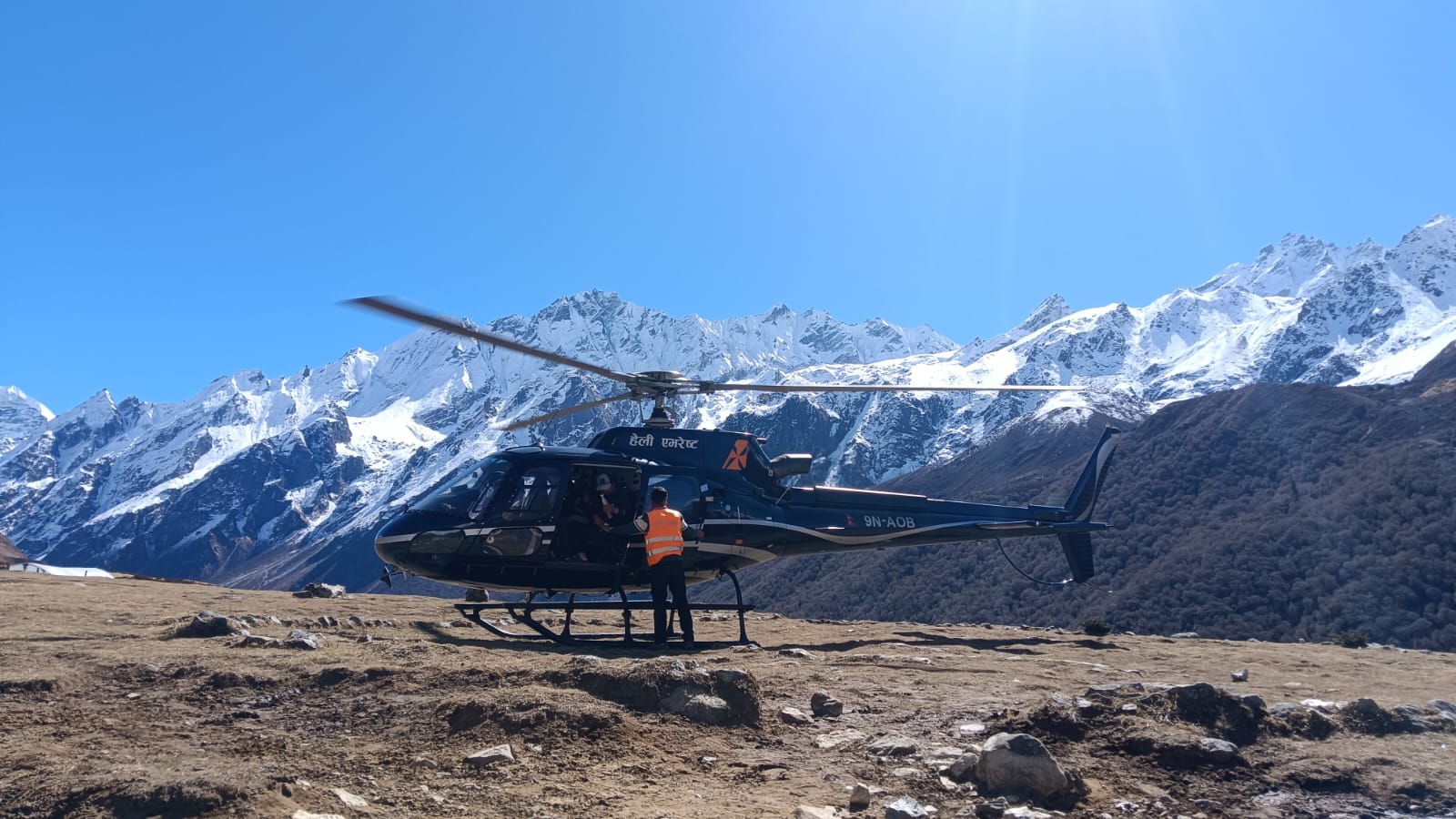
We’ll be in a high-altitude zone where there is no way to access by land transportation, meaning if any sorts of hazardous calamities or any emergency occurs, then the only way out of this situation is the evacuation through helicopter services which is why you need an insurance policy that covers your health alongside the emergency evacuation services during the emergency and please make sure that it also covers trekking up to 6,000 meters of elevation explicitly including the Unrestricted emergency helicopter evacuation.

As for the process of evacuation in the event of a severe medical emergency or advanced AMS (Acute Mountain Sickness), the lead guide holds the ultimate authority to call for an immediate satellite-coordinated helicopter evacuation to a hospital in the nearby vicinity or, if needed, the Advanced Hospital Services in Kathmandu.

And do keep in mind the fact that the money for this emergency evacuation will not be refunded, as all the resources and manpower have to be kept ready and on standby, prepaid and equipped with the necessary resources for any moment of emergency.

Guidance and logistics.

The trip is a couple of weeks long, and it’s impossible to do the trip without assistance for logistics and guidance since it involves multiple logistics, supplies of necessary resources, as it involves camping and its setup, and also cooking to be done by the trekkers themselves alongside their crew member for food.

And another important part that requires Logistics support at the elemental level is because the trek involves switching of itinerary and route from camping expectation to a standard teahouse trek through the midway, and hence adding logistics support while switching becomes much more helpful and easier during transition.

Wifi and Internet

Most teahouses offer paid services like Everest Link, though the connection becomes unstable at higher altitudes.
You can also acquire data using the data SIM card of Nepal Telecom, which is highly favoured by high-altitude travellers due to better coverage.
As for the Wi-Fi, it is usually available in teahouses and lodges.

Its coverage at lower altitudes is good but fades away with increasing altitude, and also a few dollars’ worth of charge will be charged for the usage of wifi in the high-elevation teahouse, but since it’s all about camping, it means no teahouse Wi-Fi is also available; as a result, you’ll have to acquire adequate data from your carrier.

Alternative routes

Rupina La+ Manaslu Circuit

Instead of the standard trip, if we start the trip from Barpak, then go through the rugged Rupina La pass (4,720m) and then merge with the classic Manaslu circuit trek at Nyak/Deng while making our way through the Samagaon to cross Larkya La (5,106m). Then this alternative links two massive passes, completely avoiding the busier lower trails.

Rupina La+ Tsum Valley

Rupina La is the tough one, which is why we will tackle this first. But instead of pushing towards the Manaslu Basecamp, we will diverge from there into the isolated Tsum Valley, as this transition will directly lead us to the Ancient, deeply spiritual Tibetan Buddhist sanctuary like Mu Gompa.

Barpak to Laprak/Ruby Valley

I like to suggest this to anyone to take this trail as alternative who is trying to pass and trek with full camping gear over treacherous and unmarked 4,270m pass, which is way too extreme and is also a pressure on your body regarding how extreme the geography can be on your physique which is why you divert to the lower circui as you will be starting in the historic village of Barpak and experience the cultural heart of the Gurung community with a display of Ganesh Himal.

The team.

Guide

The team will be led by a licensed, English-speaking, and very well-experienced wilderness trekking guide with extensive high-altitude and first-aid training who can help and assist you during altitude-related emergencies.

Porter ratio

The standard ratio is a 2:1 porter ratio, meaning one Porter carries a maximum baggage weight of 25KG combined for two trekkers, which means they will carry specifically 12.5 kg per client, and if you need to carry more load, then you will need to hire an extra porter.

Camping crew.

From day 2 to 7, the Rupina La Wilderness Camping section. The package includes dedicated camp cooks and kitchen hands to manage the tent setups and all wilderness meals before your arrival. Point. As they will be ready by then. To set up your camp and prepare your meal before you call it a day.

Is Solo Trekking to Rupina La Pass Worth It?

 It is only a matter of time and a matter of individual preferences.

 Whether a solo trip to Rupina La Pass is  Worth it or not ultimately boils down to your personal  Preferences. Standards and choices.

If you are someone who loves a raw, self-sustaining expedition rather than a standard tea house trip, while carrying your own essentials and accessories beyond commercialisation in the raw wilderness for 5-7 hours of each day and spending the night under the cold, chilling and beautiful night sky of the high Himalayan  While being comfortable with anything available in the least comfort zone, then this trek is absolutely for you.

Note: If you would like to skip Rupina La Pass and only do the Tsum Valley, Ganesh Himal, and Manaslu Circuit Trek, you can choose our 25-day Tsum Valley, Ganesh Himal & Manaslu Circuit Trek package.

Itinerary

If you want tailor-made trip or want to personalize this itinerary, just feel free to contact us. We are always there to help you to make your holiday plan. Contact us

Day 01

Kathmandu to Barpak ( 1915m/ 6283 ft

We start from the capital by driving westward to the trailhead (Barpak) via Pithivi Highway. The trail initially goes through famous rivers like the Trishuli and Marshyangdi rivers, and as you keep going ahead and eventually exit the valley, the mountain scene opens up. The main highway will lead the way till Abu Khaireni; we’ll be passing through the historic town of Gorkha, as the road transforms into a rugged mountain track, and we’ll be walking uphill until we get to Barpak, the official trailhead. The village of Barpak is also famous globally for being the epicentre of the 2015 devastating earthquake. One thing Barpak teaches you is the lesson of resilience and endurance from the way it rebuilt and rose post-earthquake.
Day 02

Barpak to Laprak Kharka (2,900m/9,514 ft.

Today we’ll step on the trail officially and march our way to the village called Laprak Kharka. It’s another beautiful village, and we’ll be going up. The trail up goes through stone steps leading to the Gupsi Danda ridge (~2,700m), a beautiful place that serves as a vantage point for the panoramic bursts of mountain views like Himalchuli, Boudha Himal, and the surrounding green valleys. We will be there spending some time, just soaking in the serenity of the surroundings, following which we will be moving upward as the trail goes via rhododendron and oak forest. Our destination of the day, Laprak Kharka (also known as Gai Kharka), a high alpine pasture that sits well above the main village of Laprak. The grassland is typically used by the local herders to graze their animals during that time of summer months, and tonight we will be here exchanging all of our comforts after leaving the comfort zone on the first night, under the canvas of the open sky in the tent surrounded by cool Mountain air.
Day 03

Laprak Kharka to Mizza ( 3,368m/ 11,050 ft)

So today we dive deeper into the wild, into a terrain that is non-touristic, the Gorkha Hills. We're leaving the pastures of Laprak Kharka behind, as the trail goes through the moss-draped, dense forest of bamboo and rhododendrons, and rhododendron, by the way, is the national flower of Nepal. The trail might get narrow and rugged, which is typically used by local herders and wildlife. As we hike. We will be bypassing the Rushi Kharka before pushing on towards Mizza, also locally known as Mircha/Mircha Kharka. This remote Alpine Meadow sits beautifully isolated with a backdrop of towering mountain walls and hanging glaciers. Today, we dive deeper into the wild, non-touristic terrain of the Gorkha hills. Leaving the pastures of Laprak Kharka behind, the trail contours along high ridges and through dense, moss-draped rhododendron and bamboo forests. The path can be narrow and rugged, used primarily by local herders and wild wildlife. And since there are no accommodations and the only option we have is camping. Our support crew might be ahead of us to set up the camp for the night, and as you rise in the elevation can gradually feel the thinning of the atmosphere.
Day 04

Mizza to high camp (3,800m/12,467 ft).

Today it will be comparatively a shorter day, but physically much more demanding as we will make our final approach to the foot of the pass. Moving ahead from Mizza, the trail leaves the treeline behind and enters into the stark high-alpine land of rocks, low shrubs and glacial runoff. We will maintain our steady pace as much as possible, as it helps to preserve energy and get to the top without running out of breath, which is the key factor of the ascension. So our destination is the high camp (often referred to as the Rupina La Phedi), and just like mentioned before, it's stark and dry, and at this elevation of 3,800 meters, it's very likely to get altitude sickness, so you need to prepare well beforehand. When we are above in there, the view opens like an amphitheatre which is directly beneath the pass. The mountain views from here are raw and imposing, with frozen walls of the Bouddha Himal range looming right above us.
Day 05

High camp to Tharpuk via Rupina La pass ( 4720m/15,485 ft)

We rise further up, which begins with the pre-dawn push through icy, loose surface and boulders, along with steep snow slopes. To reach the formidable Rupina La pass at 4,720 meters. One thing you need to keep in mind is the fact that no matter how high or how low the ascent is, it's always exerting pressure on the body regardless of the elevation. So walk with a strong mindset and a well-prepared and well-hydrated body. Just like the previous days, the summit today also rewards you with a panoramic Twin Valley Viewpoint, which is a great geographical. Knife-edge that splits the Daraudi River valleys behind from the rugged, granite Budhi Gandaki gorges ahead. When you stand in her,e you can feel the isolation of the location, which treats you to a front-row, jaw-dropping look at the immense southern face of Mount Manaslu (8,163 meters) before concluding the existing day with a long, careful descent down to rocky moraines, to our tented camp at Tharpuk.
Day 06

Tharpuk to Rakru (3,600m/ 11,811 ft)

Time to move ahead from the campsite. Today's journey takes us different to the wild, a wilderness that is untamed in the region of Manaslu. The trail takes us to challenging and remote landscapes which feel like a roller coaster along the alpine ridges, as we make our glacial meltwater streams and dense shrub Alpine forest. We are primarily moving to isolated value for Rechi Khola and heading towards the broad Alpine pastures of our destination, Rakru. You won't see much of the crowd in here as this is an uncommercialized territory. You will feel complete solitude under the night sky, surrounded by stars and towering mountains and unnamed mountains and the whispering of the winds through the Valley when it crashes on the mountain walls.
Day 07

Rakru to Nyak (2,960m/9,711 ft)

Time to bid farewell to the true wilderness, and we now transition back to the human settlements. We will be descending steadily from the pastures of Rakru, navigating the rugged, forested ridges and deep valleys as we drop down towards the roaring Budhi Gandaki River. Following the isolation of several days, we finally merge into the Manaslu Circuit trail before making our final climb to the Nyak, which is a beautiful traditional Gurung village that sits high on a plateau. This night offers a massive shift in comfort as we move from tent to a local tea house, which is warm and nd isolated from the chilling cold of the region and celebrate the successful crossing of Rupina La wilderness over a warm meal.
Day 08

Rest Day

Time to rest. Following the intense 7 days of rugged trekking and a major pass crossing, today will be completely dedicated to rest and recovery and other necessary work like laundry. The surroundings of the region provide you with a perfect and peaceful time and environment to recharge and heal every cell of your body from all the fatigue that your body felt from the trek. You can spend the morning sleeping in, enjoying a slow breakfast and wandering through the village’s narrow stone alleys to observe the daily rural life of the local Gurung community. For those of you who prefer an active rest day, a short hike to a nearby viewpoint offers a bird's-eye view to look down into dramatic Budhi-Gandaki Gorge, a perfect reminder of the wild terrain you just conquered. The time and choice are yours to make.
Day 09

Nyak to Chumling ( 2,386m/ 7,828 ft)

Second day since our descent began. And today we’ll descend to Chumling by losing more than half a kilometre in elevation. The trail will go over a suspension bridge over the roaring river of Budhi Gandaki. Shortly after, we reach the pivotal trail junction at Lokpa, where we officially leave the Manaslu Circuit behind and enter the hidden magical world of the Tsum Valley through a narrow forest gorge, revealing glimpses of Shringi Himal (7,161meters) through the trees. The day concludes as the valley opens up into the beautiful village of Chumling, also known as the Lower Tsum. Here, the cultural shift is immediate: classic Nepalese scenery transforms into a landscape dotted with ancient Buddhist chortens, Mani Walls, and prayer flags fluttering against the mountain breeze.
Day 10

Chumling to Chhokangparo (3,010m/9,875 ft)

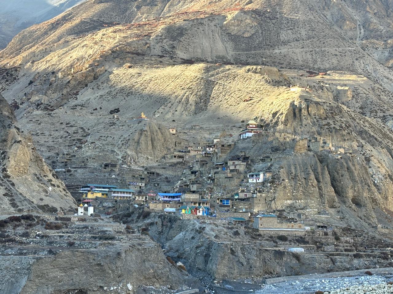
By this day, 66% of the trip is already covered. The trip today might feel abit of twist as we’re on a descent, but we’ll be rising in elevation again. We will be crossing a series of suspension bridges over the Shyar Khola and get deeper into the Upper Tsum Valley, where the landscape dramatically expands, and we’ll be climbing to get to the beautiful village of Ranjam, which takes us through the fields of barley, buckwheat and potatoes. As we go further, we reach Chhokangparo, which is a unique twin settlement joined together on a white, sun-drenched flatland beneath the towering cliffs. The settlement here is full of traditional stone houses, but the locals, known as the Tsumba people, are very well known for their warm and hospitable nature, and to make it like a cherry on top, the striking up-close views of the Ganesh Himal range make it clearer that we have entered the sacred, untouched Himalayan sanctuaries with some of the nicest people around.
Day 11

Chhokangparo to Chule (3,360m/11,023 ft)

We will be walking further up and deeper into the Tsum Valley, and the trail flattens out into the wide, beautiful glacial valley carved by Shiyar Khola. The hike today will be deeply spiritual and visually stunning one, passing clearly charming stone villages like Leru and Pangdun along the way, we will visit. Along the way, we’ll visit the sacred Milarepa’s Cave (Piren Phu), where the famous Tibetan saint is said to have meditated, offering a glimpse of ancient Buddhist history etched right into the cliffs. Since it’s a cliffside, we’ll climb gently to Chule, a traditional, flat-roofed Tibetan village that sits on the opposite side of its sister town, Nile. The views tof he surroundnig snow-capped peaks grow more and more intimate as we settle in for the night.
Day 12

Chule to Mu Gompa (3,700m/12,139 ft)

If you look at the elevation chart of today, then it’ll take us to the absolute northernmost and the highest point of the Tsum Valley portion of the trip. The trail goes parallel to the thinning Shiyar Khola that feels increasingly like the Tibetan Plateau, stark and dry. When we finally get to the Mu Gompa, an ancient and deeply revered monastery established in 1895 that stands as the largest monastery in the region, standing on the isolated, high wind-swept ridge, it offers an Incredible sense of peace and unmatched panoramic views of the surrounding borders of Tibet. We will spend the afternoon exploring the monastery, interacting with local monks and taking in the raw majesty of the high-altitude wilderness before enjoying a quiet evening in the remote sanctuary.
Day 13

Mu Gompa to Chhokangparo ( 3,700m/ 12,139 ft)

Time to say goodbye to the high-altitude sanctuary of this portion of the trip, Mu Gompa and begin our return journey down the valley. Because we are traveling downhill, we will retrace our step it much faster and easier pace following the course of the Shiyar Khola. We will pass back through the familiar twin villages of Chule and Nile, enjoying a new perspective on the towering Ganesh Himal range, now framing our descent. If you have missed it on the way up, you will have another chance to visit Historic Rachen Gompa, which is a prominent nunnery nestled in the valley floor. The day ends as we arrive back in Chhokangparo, where the air feels a bit warmer and thicker, letting us relax comfortably in a familiar tea house for the evening.
Day 14

Chhokangparo to Gumba Lungdang (3,540m/11,614 ft)

We are getting down, and we will do it by descending to the village of Domje, where we cross this Shyar Khola and leave the mainstream valley highway behind to venture into the rugged, less-trodden Trail. From the river, the path climbs a steeply wild ridge winding through dense, mossy forests of the Rhododendron and pine. Our destination is Gumba Lungdang, the ancient and intensely isolated Buddhist nunnery perched spectacularly against the mountain slopes.
Day 15

Gumba Lungdang to Ganesh Himal Base Camp (4,200m/13,780 ft)

Time to climb high again. Feels like just up and down, doesn't it? Like, firstly, we were climbing, then we're descending, now we are climbing again. But one of the good things about this day is that we don't have to acclimatise, since we have already been to the highest point possible before, which has already made our body easier to adapt to the thin air. And just like the old times, the trail will be a wild one, a rugged path full of dense wilderness before it breaks out into the raw, rocky glacial giant amphitheatre view of the Ganesh Himal Base Camp, with an elevation of 200m beneath the massive and frozen face of the Mountain itself. It will be an unforgettable sight when you get that up close view of the mountain. Following that, we will be retracing our steps back down the bridge, and you will spend the night peacefully under the cold sky in a familiar peaceful environment of the nunnery, Gumba Lungdang (3,540m)
Day 16

Ganesh Himal Base Camp to Ranjam ( 2900m/9,540 ft).

Moving ahead from the base camp today, we start descending again. After leaving the high-altitude glacial basin of the Ganesh Himal behind, we'll be tracing our steps back to the Gumba Lundang. Walking down the steep path, mossy forest of rhododendron bushes and pine trees. Don't forget to adjust your posture and baggage while getting down, as it is a significant drop of more than a kilometre which will exert very much pressure and strain on your knees, but there is a silver lining too: as you drop down, the atmosphere will be thicker, and your lungs and body will start to feel rejuvenated, circulating with the oxygen, feeling much fresher. The trail goes all the way down to Shiar Khola River before bringing you back to the warmth, hospitality, and welcoming surroundings of the Tea House and the locals, where you can comfortably spend the evening and stay overnight to recover your body.
Day 17

Trek from Ranjam- Lokpa ( 2240m/7,349 ft)

Today we officially exit from the inner sanctuary of the Tsum Valley. Following the exit, we will start getting back on the steps to Shyar Khola valley. The trail goes like a snake, winding through deep, dramatic gorges across several high swaying suspension bridges that are framed by final glimpses of Shringi Himal. The trail downhill will be a mix of sharp, short sections with a forest full of pine and rhododendron. As the day concludes, we arrive at the narrow entry post the village of Lokpa, the main gateway back to the Manaslu Circuit track.
Day 18

Trek from Lokpa-Bihi (2,310m/6,988 ft)

Heading for Bihi officially joins the Manaslu Circuit. The path drops into a narrow, dramatic wilderness that is stretched and characterised by Deep River gorges, bamboo groups and dense, dense forest canopies. We're tracking the standard course of the Budhi-Gandaki River, navigating a series of undulating stone steps and suspension bridges. As we progress past the remote river junction, the Landscape shifts to reveal the region’s initial Tibetan influence: mani walls. The day ends with a steady, final incline to the traditional village of Bihi.
Day 19

Trek from Bihi-Namrung (2,660m/8,727 ft)

Post departure from Bihi, the trail follows Budhi-Gandaki river that goes through scenic sub-alpine landscape of dense oak, fir and rhododendron forest. After which you are officially in the culturally Nupri region of Tibet, which is marked by extensive money, while ancient chortens and prayer wheels. This day involves crossing multiple suspension bridges while tackling a series of Steady uphill stone staircases. The journey concludes in a large village of Namrung, which is a major checkpoint offering early and beautiful views of Ganesh Himal and Shringi Himal.
Day 20

Trek from Namrung to Syala (3,575m/11,729 ft)

Today it will be a visual transition as you enter the white Alpine landscape of the Upper Manalsu region. Departing from Namrung, the trail climbs steadily through a beautiful Alpine Meadow, traditional stone houses and the local apple orchards, passing through the culturally rich village of Lho. The day concludes as you step into the high valley of Syala, which feels like a giant screen in front of you that displays a beautiful, natural scenario of the mountain panorama 360 degrees around you. Click the pictures, capture the moment, create memories because some moments are just once in a lifetime.
Day 21

Trek from Namrung-Samagaon ( 3,530m/11,581 ft)

Speaking of stepping into the third week, Today we go deeper into the heart of the Nupri region through a wide, dramatic glacial valley. Would require a steady climb from Namrung, passing through the historic villages of Lhow, with its prominent Ribung Gompa, before we enter the high-Alpine pastures of Syala, from where the path levels out into an expansive rocky valley floor, flanked by towering peaks and mountains. The day gradually comes to an end, concluding in Samagaon, which is the largest and most important cultural hub of the Upper Manaslu and serves as the primary base for exploring the Birendra Lake and preparing for the Larkya La Pass.
Day 22

Rest day at Samagaon (4,040m/13,254 ft. Optional side hike to Birendra Lake or Pungyen Gompa)

We have worked a lot, with ups and downs. Screech slope, Slippery roads and trails. Which have exerted a lot of pressure on our bodies. So we need time for recovery, which is today. Today we will ensure that we get active rest during the daytime for our body to recover from all those days of strain. You might feel like this is acclimatisation, but it's much more like a Recovery phase, as we have already been to some of the highest places of the trip and also acclimatised before, so it doesn't matter much more; rather, this is more of a Recovery and is something much more important. But also, if you recover quickly from the trip during the rest time and want to walk around and see around, then we can also visit the Birendra Lake, with glacial turquoise-coloured water which feels like a completely isolated gem of nature cradled beneath the icefall of Mount Manaslu. For a more physically demanding and spiritual experience, you can also ascend to the Pungyen Gompa, which is an isolated monastery perched on a high-altitude plateau and rewards the hikers with unparalleled front row views of Mount Manaslu’s massive eastern face.
Day 23

Trek from Samagaon to Samdo (3,860m/12,664 ft)

Once again, we followed the lead of the Budhi Gandaki River, Who is your lead us to a wide valley of Alpine desert. We will be passing long Mani walls and juniper bushes while making a steady climb between the high pasture lands. We’ll be making a final climb to Samdo, a remote Tibetan refugee village situated just a day's walk from the Tibetan border.
Day 22

Trek from Samdo to Dharamasala (4,460m/14,632 ft)

Heading to Dharmasala, we will be crossing the suspension bridge over the Budhi-Gandaki River the final time before the trail begins its upward pull towards the pass base camp. The landscape turns completely stark, rocky and alpine as you pass the old ruins of Larkya Bazaar and track the edge of a lateral Moraine. The thin air will naturally slow you but keeps the sweeping views of Larkya Glacier and the surrounding peaks, keeping motivation high. The trek concludes at Dharmasala (aka Larkya Phedi), a remote high-altitude outpost consisting of basic stone shelters and seasonal tents where you’ll eat an early dinner and rest ahead of tomorrow's big crossing.
Day 24

Trek from Dharmasala to Bimthang ( 5,106m/16,752 ft)

Keep yourself fit all the time by maintaining your physical mobility by doing certain exercises, even if light, as the exercise helps you keep the blood flow proper and walk uphill or downhill with a bit of ease. And I'm telling you this because today is the one, the most demanding day of the trip. We will be starting our trip before the dawn breaks, climbing the glacier’s edge steadily along the trail to reach the summit 5,106m. The view once at the top will be a rewarding moment of use of Himlung Himal, Cheo Himal and Kang Guru. The day ends with a flat walk into the peaceful alpine basin of Bimthang.
Day 26

Trek from Bimthang to Tiliche (3,720 m/ 12,204 ft)

Leaving Bimthang, it feels amazing because your lungs finally get real oxygen again, but your knees are definitely gonna feel it. You start high up in that elevation and gradually dive straight down into this crazy beautiful thick forest with tons of massive rhododendrons and pine trees everywhere, with moss hanging off them. It’ll be a very calm, serene and soothing walk. It's pretty much a non-stop downhill walk following the Dudh Khola River. You will pass a tiny little spot called Goa where most people grab a quick dip, and then you just keep coasting down until you hit Tiliche. Tiliche is really cool, old Gurung village with neat stone-paved streets, and honestly, just having a warm bed and thick air to breathe makes it the best feeling ever after that high-altitude freeze.
Day 27

Drive from Tiliche to Besisahar to Ktm/Pokhara

All right, today is the day you finally swap the Hiking boots for the wheels, and honestly, it's a total bumpy ride adventure to wrap things up. You’ll start by riding a jeep from Tiliche all the way down through bumpy and rocky winding dirt roads along the Marshyangdi River until you hit Besisahar, which takes a few solid hours of shaking ground. And once you are here, the rugged mountain trails are officially behind you, and you will switch over to a bus or private vehicles for a long drive back to the capital or Pokhara, depending on your choice and Itinerary.

Inclusions

What's included

  • Airport transfers - pickup and drop off
  • Meals on full board (Breakfast, lunch and dinner) during trekking period.
  • 2 nights 3 star hotel in Kathmandu
  • An experienced Government-licensed guide.
  • Food, drinks, accommodation, insurance, salary, equipment, transportation, local tax for guides and porters.
  • Public bus from Kathmandu to Barpak.
  • Besisahar to Kathmandu by private car.
  • All transfer to Bus station by private vehicle
  • All necessary permits and special paperwork
  • All government taxes and our service charges.
  • Farewell Dinner before departure.
  • Himalayan Guide Treks T-shirt

What's not included

  • International airfare and visa fees
  • Accommodation and meals in Kathmandu.
  • Beverages including tea, coffee, soft drinks, beer, and mineral water.
  • Personal trekking gear and shopping expenses.
  • Amenities such as hot showers, battery charging, boiled water, and Wi-Fi.
  • Travel insurance covering emergency rescue.
  • Tips for staff.

Frequently Asked Questions

What's the total distance of the Manaslu circuit trek?

The Manaslu circuit trek covers a total walking distance of approximately 177km/110 miles.

How high is the Larkya La Pass?

The highest point of the trip is Larkya La Pass, at an elevation of 5106m (16,752 ft).

Is the guide mandatory for the Manaslu circuit trek?

Absolutely, because the government of Nepal legally requires a licensed trekking guide for the Manaslu restricted area.

Can I do the Manaslu circuit trek solo?

No, solo trekking is not permitted to do as you must trek with a licensed guide and a minimum group size of two people.

What permits do I need for the Manaslu circuit trek?

You need Manaslu RAP (Restricted Area Permit), MCAP (Manaslu Conservation Area Permit) and ACAP (Annapurna Conservation Area Permit).

How long does the Manaslu circuit trek take?

A standard Manaslu circuit trek itinerary takes somewhere from 14 to 18 days, depending on the side trips and acclimatisation days.

What's the best time for the Manaslu circuit trek?

The best time to do the Manaslu Circuit trek is during the peak season in autumn, i.e., September- November, and spring (March to May).

How difficult is the Manaslu circuit trek?

The trip is classified as strenuous due to remote trails, high altitude, and challenging crossings of Larkya La Pass.

What kind of accommodation is available on the Manaslu circuit trek trail?

The trail features local family-run teahouses providing basic private twin rooms and shared bathroom facilities.

Is the Internet or Wi-fi available during the trek?

Yes, most teahouses offer paid services like Everest Link, though the connection becomes unstable at higher altitudes.

Which mobile network SIM card works best on the Manaslu Circuit trek?

Nepal Telecom (NTC) offers the most reliable cellular network coverage across the region during the Manaslu Circuit trek.

How do I prevent Acute Mountain Sickness (AMS) on the trek?

Prevent AMS by following a gradual ascent itinerary, taking dedicated rest days, and drinking four to five litres of water daily to hydrate well.

Does travel insurance need to cover helicopter rescue?

Yes, your insurance policy must explicitly cover emergency helicopter evacuation up to an elevation of 6000 meters.

Can I charge my camera, batteries and phone on the trek?

Yes, tea houses provide charging stations in common areas with a small extra fee powered by solar or local hydroelectricity.

Is it possible to combine Tsum Valley with the Manaslu circuit trek?

It's possible to do so by adding an extra six to seven days and securing a separate Tsum Valley restricted area permit.